More than 11 billion tons of cargo are handled by seaports worldwide each year, accounting for 80% of total trade. Seaports serve as trading hubs that allow exporters to reach their global target markets. Although it may seem simple, managing international shipping involves more preparation than just logistics, routes, and seaports, as anyone who has been practicing as a sailor knows. The World Seaports Map is useful in this situation. Exporters can use this application to expand their delivery routes, cut costs, and grow their enterprises.
The World Seaports Map: What Is It and Why Does It Matter?
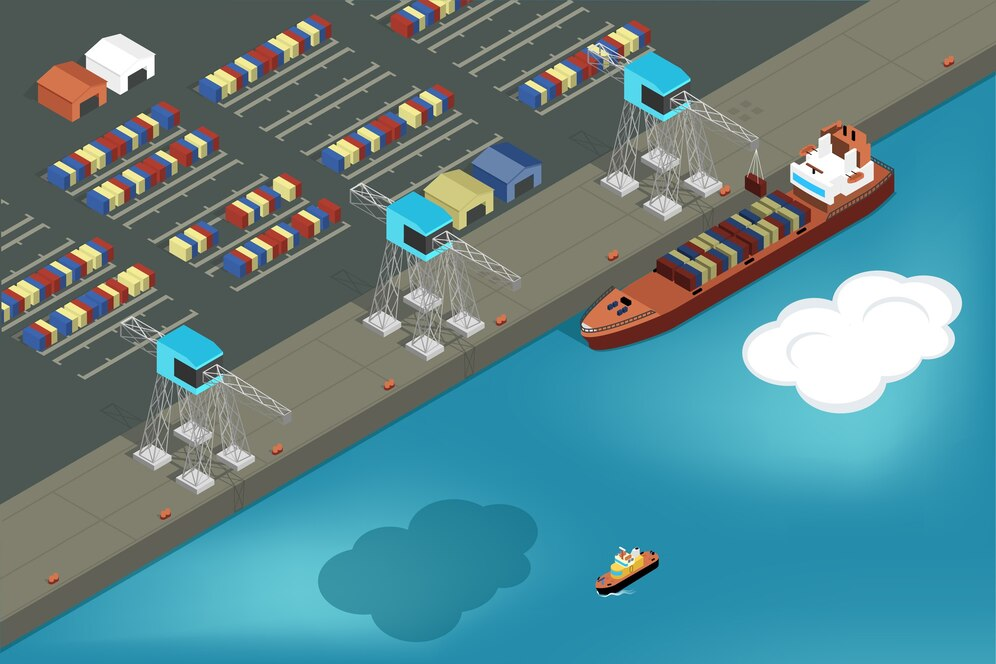
A multipurpose online database, the World Seaports Map provides general information about the major and minor seaports around the world. It includes basic information about harbors, such as their sizes, locations, cargo equipment, and trades.
The World Seaports Map’s Significance
- Improved Logistics Planning: Shippers are able to determine which ports is the fastest and nearest for transporting cargo.
- Cost-Effectiveness: Transportation expenses are reduced by effective routes.
- International Market Access: The idea of seaport networks makes it easier to get into new markets.
- Real-Time Data: These maps include real-time traffic updates, so exporters may make the appropriate adjustments in the event of bad weather or traffic jams, among other situations.
Important Elements of the Map of World Seaports
Data, as displayed on the World Seaports Map, offers a number of sophisticated features designed to make international trading simple for exporters. Exporters can maintain their competitiveness in the ever-changing world of international trade by being aware of these capabilities.
1. Comprehensive Port Profiles : The World Seaports Map provides users with information to help with marine business and transactions, as well as port profiles. These profiles include details about the types of cargo that the port handles and receives, such as bulk cargo shipping, special cargo, and containers (such as reefer containers, flat rack containers, and open top containers).
The map also shows other vital transportation networks, such as highways, railroads, and warehousing and logistics facilities that are crucial for the movement of goods once it leaves the port.
2. Interactive Navigation : The World Seaports Map is easy to navigate thanks to the integration of several practical navigation choices. When assessing smaller regions or trade areas, its digital form allows users to zoom into particular places (as well as seaports) to explore areas of interest in greater depth. Users may easily locate particular ports, nations, regions, or names thanks to the search function, which also improves usability.
3. Instantaneous Updates : The ability to display real-time data is maybe one of the greatest aspects of the World Seaports Map today. Important information about the current weather, the level of congestion, and the updated cargo schedules is provided by this feature.
The map facilitates more effective and efficient option production, evaluation, and selection; it adjusts to changing circumstances.
Seaports’ Influence on International Trade
Seaports are important sites for international trade and the introduction of raw resources and merchandise. The availability and costs of the supply chain are impacted by efficient seaport management.
The Best Seaports for Exporters to Know
China’s Shanghai Port is the busiest port in the world, handling more than 47 million TEUs a year.
Port of Singapore: Singapore is a wonderful port because of its location and sturdy architecture. The largest port in Europe and the Continental Gateway is Rotterdam Port in the Netherlands.The main hub for trade between Asia and North America is Los Angeles Port in the United States. A significant trading and logistics center in the Middle East is the Port of Dubai (Jebel Ali), United Arab Emirates.
Utilizing the Global Seaports Map to Improve Logistics Scheduling
Exporters can use the World Seaports Map to better organize their shipping process:
Route optimization is the process of looking for the most cost-effective ways to move the product.
- Cargo Consolidation Points: To reduce expenses, find seaports that offer consolidation services.
- Contingency Planning: To reduce damage and lost time, it is advisable to look for alternate ports within the impacted area.
- Trade Expansion: For ports with the potential for rapid future expansion, this has not yet been noted.
Understanding the World Seaports Map is beneficial, particularly for exporters. This technology helps exporters minimize expenses, logistics, and market access while accomplishing strategic international trade.
Reach Out to Us
We at CargoesPi provide specialized shipping options to meet the unique requirements of your company. To find out how the World Seaports Map and our experience may improve your supply chain and shipping operations, visit our website or send us an email at [email protected].
FAQs
How may exporters benefit from the World Seaports Map?
The map helps exporters better understand the best shipping routes, pricing, and access to new markets by providing vital logistical information.
Is there a free version of the World Seaports Map?
Advanced versions with less capabilities (including real-time updates and analytics) need a subscription, but there are free versions as well.Explore the current version of the World Seaports Map and use CargoesPi to export even more!