Architectural teams adopt digital reality capture to document existing structures with high spatial accuracy. Laser scanners transmit pulses toward surrounding surfaces and measure reflections from building elements. The device records millions of measured points every second and converts these measurements into coordinate data. Each recorded point contains X, Y, and Z spatial values that represent the exact position of physical geometry. This dataset forms a point cloud that describes the shape and dimensions of a building. Digital capture replaces manual tape measurements and field sketches through automated spatial recording across entire architectural environments.
Laser scanners determine distance through two measurement principles: Time of Flight and Phase Shift ranging. A TOF scanner emits a laser pulse and records the round-trip travel duration between emission and surface reflection. The system multiplies this travel duration by the speed of light to calculate distance with millimeter precision. Phase-Shift scanners transmit continuous modulated waves and analyze phase differences between outgoing and returning signals. Phase-Shift instruments capture extremely dense point clouds within shorter scanning ranges, which supports detailed architectural documentation.
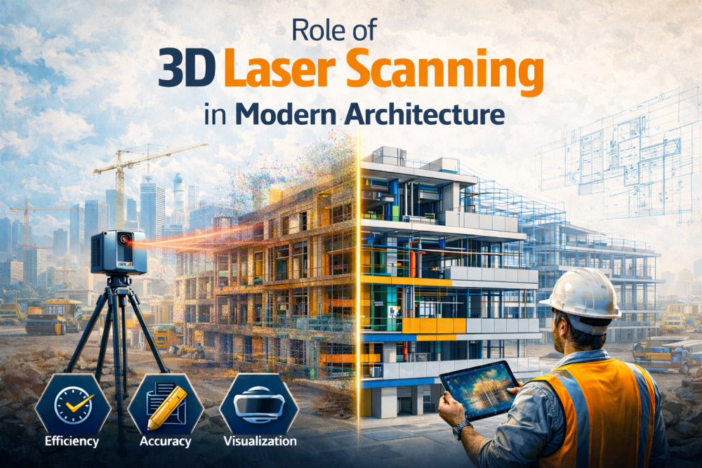
The method of3D laser scanning in architectureincludes the use of laser technology to create accurate physical records of building sites.The system operates by rotating its scanning device to project multiple laser beams onto various surfaces of the building. The system creates a dense Reality Capture Dataset through its ability to capture multiple coordinate points from each mirror reflection. Architects use this spatial dataset to analyze building design elements, which include building shapes, façade positions and structural connections.
How 3D Laser Scanning Technology Works?
A laser scanner uses a rotating mechanism which moves from side to side and from up to down while it projects laser beams throughout the entire area around. The system uses LiDAR technology that enables laser beams to bounce off surfaces to return to an internal photodetector that measures both the signal strength and the angle at which the light hits the detector. The device calculates range through reflected signals and records azimuth and elevation angles for each return. Processing algorithms convert these measurements into Cartesian X, Y, and Z coordinates. The scanner aggregates these coordinates into dense point clouds with densities reaching two million points per second.
Survey teams capture multiple scans across interior and exterior zones of a project site. Registration software aligns these scans through target-based alignment or cloud-to-cloud matching algorithms. This process merges separate datasets into a unified coordinate system for accurate spatial representation. Teams export registered 3D Spatial Data in formats such as .E57 or .PTX for modeling workflows. Advanced terrestrial LiDAR scanners help in demonstrating accurate measurements to distances of one hundred meters during architectural surveys.
Importance of Laser Scanning for Architectural Projects
The laser scanning process delivers precise as-built documentation, which shows current building conditions. Survey teams deploy scanners across interior spaces, façades, and structural zones to capture spatial relationships among architectural components. The scanner records millimeter level measurements that reveal column misalignment, slab variation, and façade displacement. Architects interpret this spatial dataset during design development and renovation planning. Digital point clouds also support coordinated planning among architects, engineers, and construction teams through a shared geometric reference derived directly from site conditions.
The types of 3D laser scanners for BIM include:
- Terrestrial scanners: Tripod mounted LiDAR systems that collect high density point clouds, covering interior spaces, building façades and structural elements.
- Mobile scanners: Backpack or cart-based scanners to capture spatial data while operators walk through large facilities and campuses.
- Aerial scanners: Drone LiDAR instruments operate as aerial scanners, which inspect rooftops, towers and large construction sites from high altitude positions.
Project scale determines scanner selection and capture strategy. Terrestrial scanners capture dense geometric detail within confined architectural spaces. Mobile scanners record extensive corridors, infrastructure zones, and industrial facilities through dynamic scanning paths. Aerial LiDAR platforms document roofs, façades, and elevated structural systems. The process helps in accurate digital documentation for complex architectural environments.
Key Benefits of 3D Laser Scanning in Modern Architecture
The role of 3D laser scanning in architecturefocuses on accurate spatial documentation and systematic reality capture of existing structures. Terrestrial LiDAR scanners record millions of measurements across walls, floors, façades and structural components during a single survey campaign. Architects convert these measurements into dense point clouds that represent building geometry with millimeter level accuracy. This digital dataset supports design validation, spatial verification and accurate architectural documentation across modern construction workflows.
Key benefits include:
- High-resolution point clouds reveal hidden utilities, structural deviations, and irregular surface geometry within existing buildings.
- Scan datasets support clash detection through geometric comparison between existing conditions and proposed BIM models.
- Processing software extracts floor plans, elevations, and sectional views directly from registered Laser Scan Data.
- Contractors analyze sectional slices of scan data to study construction sequencing and installation alignment.
- The registered scan data helps create immersive walkthrough visualizations that project stakeholders and design teams can use for their work.
Applications of Laser Scanning in Architectural Design and Renovation
- Architects use 3D laser scanning for buildings to capture accurate as-built conditions and generate BIM models that guide renovation planning and structural analysis.
- Design teams use registered Reality Capture Dataset to create BIM environments where they test architectural models for their spatial alignment with proposed building extensions and renovation areas.
- Interior planners use scan data to create maps, displaying ceiling grids, wall penetrations, structural framing and service zones, which they need to build accurate interior layouts.
- Registered scan datasets provide engineers with data to design MEPF routing systems which must work around existing ducts and pipes and structural components.
- Project teams prepare digital twins from scan datasets and analyze building systems to support facility upgrades, operational planning, and long-term infrastructure management.
Laser Scanning for Historic Building Documentation
The process of laser scanning construction sites enables accurate historical building documentation through its capability to capture remote digital measurements. Terrestrial LiDAR scanners produce precise point cloud data which records architectural elements including ornamental cornices, vaulted arches, carved stone elements and the curved shapes of building facades. The high-density scanning modes allow users to obtain both detailed surface structure information and data about structural movement and material deterioration and ongoing settling processes. Conservation architects study deviation maps, which result from scan data, to determine the current state of structural integrity. The specialists transform these datasets into meshes and parametric models, which enable restoration planning and digital preservation archiving and virtual heritage structure visualization.
Challenges in Using 3D Laser Scanning in Architecture
Advanced LiDAR scanning equipment requires significant financial investment for high-precision terrestrial systems and supporting accessories. Organizations evaluate project scale, scanner range, and capture density before selecting appropriate hardware for architectural documentation and surveying tasks.
Laser Scanned datasets contain millions or billions of spatial measurements that demand powerful computing systems. High performance GPUs and specialized software process scan registration, filtering and visualization tasks during analysis and modeling workflows.
3D scanning operations require trained specialists who understand scanner calibration, data acquisition and interpretation. Professionals configure scan positions, manage reflective surfaces and prepare datasets for integration into architectural design and BIM environments.
Integration of Laser Scanning with BIM Workflows
Laser scan to BIM services convert scanned information into structured Building Information Models that represent existing building geometry. Specialists import .RCS or .RCP files into Autodesk Revit and align point clouds with project coordinate systems. The modeling environment displays scan data as a spatial reference layer for BIM reconstruction. Modelers trace walls, slabs, columns, and façade elements directly from dense scan geometry. Parametric BIM objects derived from these datasets support design validation, clash analysis, construction coordination, and facility management workflows.
Final Thought: Future of 3D Laser Scanning in Architecture
Laser scanning in construction industry workflows advances through artificial intelligence and automated feature recognition. Machine learning algorithms analyze datasets and identify building components such as walls, doors, pipes and structural frames. These capabilities accelerate geometric interpretation and support rapid architectural documentation.
Mobile LiDAR platforms and drone scanning systems expand digital reality capture across large construction sites and infrastructure corridors. These technologies record extensive spatial datasets within short survey durations. Augmented reality overlays display scan geometry directly on-site for verification and spatial analysis. Affordable handheld scanners increase accessibility and support wider adoption of digital surveying tools across architectural and construction environments.